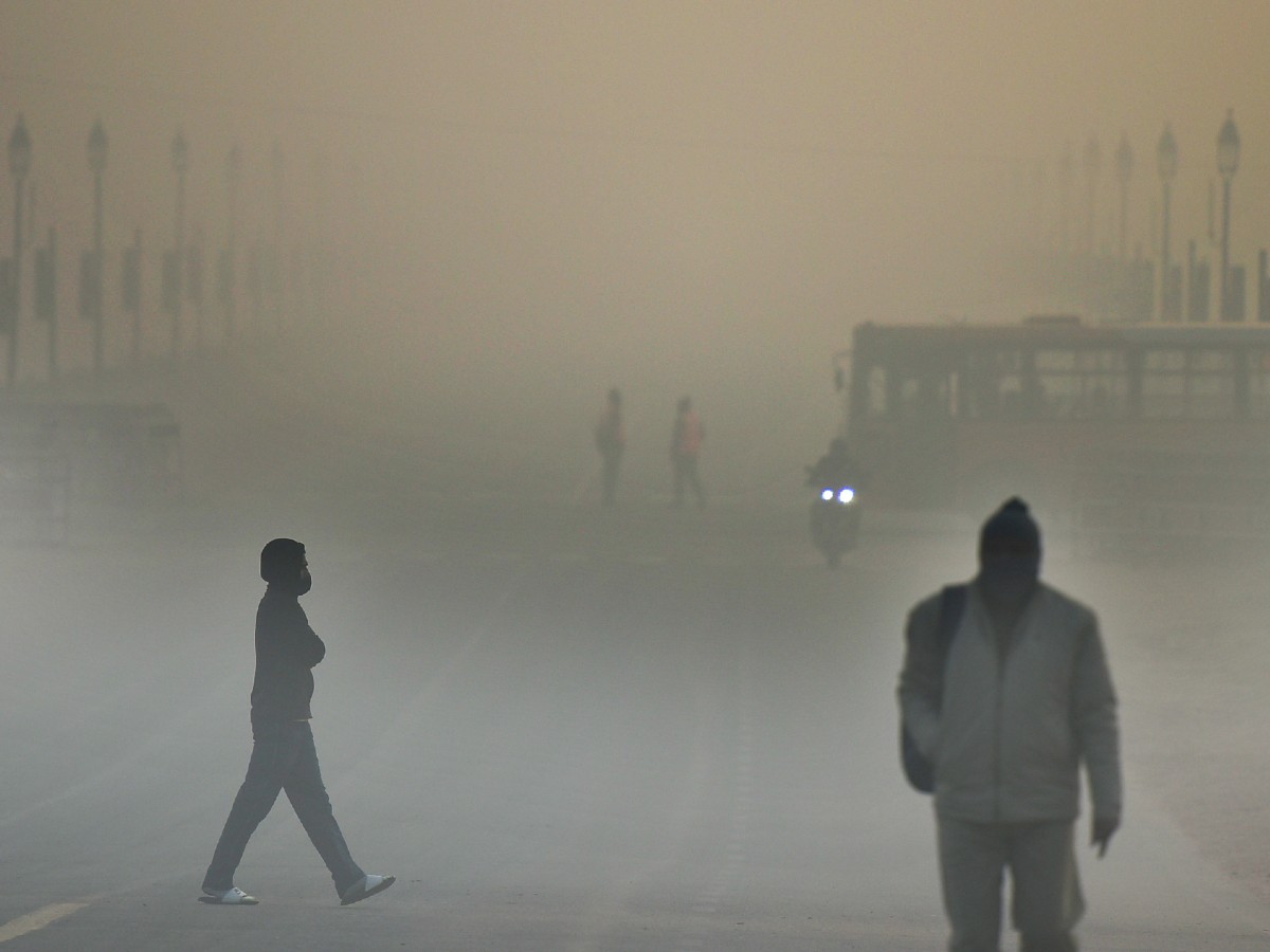
Cold conditions abated slightly in Delhi on Wednesday, though the relief is predicted to be short lived.
Fourteen trains to Delhi were reported running late due to dense to very dense fog in other areas, a Railways spokesperson said.
The Safdarjung observatory, Delhi’s primary weather station, recorded a minimum temperature of 6.3 degrees Celsius against 5.6 degrees Celsius on Tuesday and 5 degrees Celsius on Monday.
At 5.6 degrees Celsius, Delhi’s minimum temperature on Tuesday was less than that of Dharamsala (6.2 degrees Celsius), Dehradun (7 degrees Celsius), and Nainital (7.2 degrees Celsius).
Meteorologists attributed the spell of cold wave and below-normal day temperatures in northwest India to frigid north westerly winds barrelling through the plains and reduced sunshine due to foggy weather.
Mahesh Palawat, vice president (meteorology and climate change), Skymet Weather, said a western disturbance led to a fresh spell of snowfall in the mountains on December 25-26 and cold northwesterly winds swept through the plains after its retreat.
He said the wind chill factor — a measure of the rate of heat loss from skin that is exposed to the air — was also high.
A cold day is when the minimum temperature is less than or equal to 10 degrees Celsius below normal and the maximum temperature is at least 4.5 degrees below normal. A severe cold day is when the maximum is 6.5 degrees or more below normal.
The windchill factor is based on wind speed. The higher the wind speed during cold weather, the colder it feels on the skin if a person is outside. Delhi clocked a top wind speed of 16 kilometres per hour on Tuesday.
Palawat said coldwave conditions in northwest India would abate from Wednesday under the influence of a fresh western disturbance. However, the relief is likely to be short lived.
The minimum temperature will drop again after the WD, characterised by warm moist winds from the middle east, retreats, he said.
The national capital shivered under a severe cold day on Monday, with the maximum temperature dropping 10 notches below normal at some places.
The Safdarjung observatory recorded a maximum temperature of 15.6 degrees Celsius on Monday, six notches below normal and the lowest day temperature in December since December 17, 2020.
On Tuesday, Safdarjung logged a maximum temperature of 17.2 degrees Celsius, three notches below normal. It is likely to settle around 19 degrees Celsius on Wednesday and 20 degrees Celsius on Thursday.
An IMD official said fog duration, intensity and area covered significantly reduced on Wednesday morning across north India including over Delhi-NCR.
“All airports in Delhi and Uttar Pradesh have shallow fog only. Chandigarh also reported shallow fog. However, Pathankot, Jammu and Amritsar have dense fog today,” the official said.
According to the India Meteorological Department (IMD), very dense fog is when visibility is between 0 and 50 metres, 51 and 200 metres is dense, 201 and 500 moderate, and 501 and 1,000 shallow.
In the plains, the IMD declares a cold wave if the minimum temperature dips to four degrees Celsius or when the minimum temperature is 10 degrees Celsius or below and is 4.5 notches below normal.
A severe cold wave is when the minimum temperature dips to two degrees Celsius or the departure from normal is more than 6.4 degrees Celsius.
(With PTI inputs)
Follow us on:
Instagram: instagram.com/thepatriot_in/
Twitter: twitter.com/Patriot_Delhi
Facebook: facebook.com/Thepatriotnewsindia