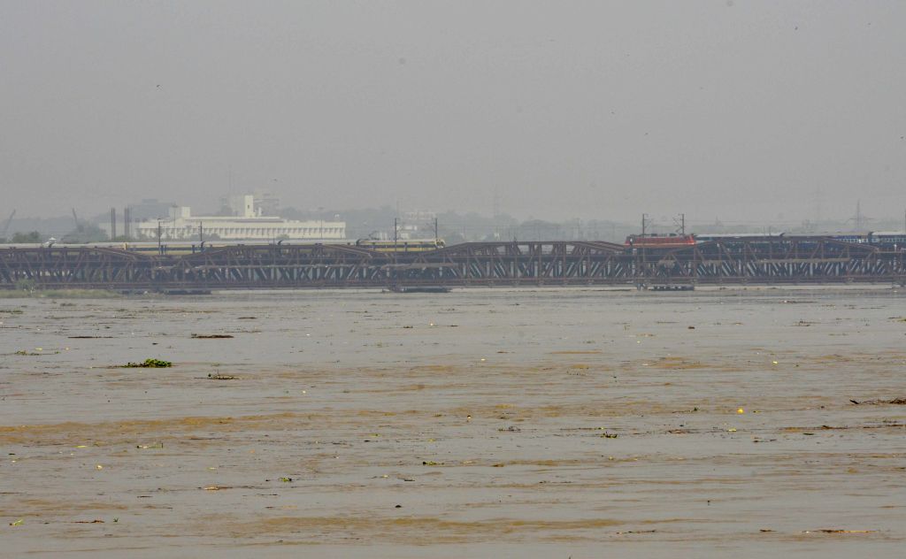
The Yamuna River in Delhi has surpassed the evacuation mark of 206 meters, leading officials to initiate the relocation of people residing in flood-prone areas to safer locations, as announced on Tuesday.
The river exceeded the danger mark of 205.33 meters on Monday evening, much earlier than anticipated. The Central Water Commission’s flood-monitoring portal reported that the water level at the Old Railway Bridge had risen to 206.28 meters by 6 am on Tuesday, following the release of additional water by Haryana from the Hathnikund barrage in Yamunanagar.
According to officials, nearly 7,500 people have been evacuated and shifted to camps so far by the Delhi government; in many places people have themselves erected tents on the higher grounds and shifted to them to avoid rising waters.
It is predicted that the river’s level will rise to 206.65 meters by Tuesday afternoon, before gradually subsiding. Addressing a press conference on Monday, Chief Minister Arvind Kejriwal expressed that while a flood-like situation is unlikely in Delhi, the city government remains prepared to tackle any eventuality. He further stated that the evacuation process would commence once the river breaches the 206-meter mark.
Officials from the East Delhi district confirmed that the evacuation process began on Monday night, after floodwaters entered several areas. “Only those residing in the affected regions have been shifted to camps on higher grounds,” stated an official.
The irrigation and flood control department said that the flow rate at the Hathnikund barrage had surged to the 3 lakh cusec mark on Monday. Typically, the flow rate at the barrage is around 352 cusecs, but heavy rainfall in the catchment areas has caused a significant increase in discharge. It is worth noting that one cusec is equivalent to 28.32 liters per second. The water from the barrage takes approximately two to three days to reach Delhi.
In response to the situation, the Delhi government has established 16 control rooms to monitor flood-prone areas and the water level of the Yamuna. Quick response teams and boats have been deployed as a precautionary measure.
Northwest India has experienced incessant rainfall over the past three days, resulting in “heavy to extremely heavy” precipitation in various areas of Jammu and Kashmir, Uttarakhand, Himachal Pradesh, Haryana, Uttar Pradesh, and Rajasthan. This continuous downpour has caused overflowing rivers, creeks, and drains, severely damaging infrastructure and disrupting essential services in Jammu and Kashmir, Himachal Pradesh, Uttarakhand, and Punjab.
Delhi, in particular, witnessed its highest rainfall (153 mm) in a single day in July since 1982, in the 24-hour period ending at 8:30 am on Sunday. An additional 107 mm of rainfall occurred in the subsequent 24 hours, exacerbating the already critical situation. The heavy rain transformed roads into gushing streams, parks into watery labyrinths, and marketplaces into submerged realms.
In response to the torrential rain, the Delhi government declared the closure of all schools on Monday and cancelled the Sunday leave of government officials, instructing them to be in the field.
The catchment area of the Yamuna river system covers parts of Uttar Pradesh, Uttarakhand, Himachal Pradesh, Haryana, Rajasthan, Madhya Pradesh, and Delhi. The low-lying areas near the river in Delhi are considered highly susceptible to flooding and are inhabited by approximately 41,000 people.
Over the years, despite the land belonging to the Delhi Development Authority (DDA), revenue department, and private individuals, encroachments on the river floodplain have taken place.
The Yamuna breached the danger mark twice in September last year, with the water level reaching 206.38 meters. In 2019, the river witnessed a peak flow rate of 8.28 lakh cusecs on August 18-19, and the water level rose to 206.6 meters. The river had reached an all-time record water level of 207.49 meters in 1978. (With inputs from PTI)


