Running from August 2 to September 22, the exhibition presents nearly 100 rare and detailed maps, showcasing India’s rich history through the lens of cartography.
The exhibition offers a deep dive into India’s historical and cultural landscape, highlighting the evolving nature of its geography.
“The maps in this exhibition are more than just navigational aids—they reflect the changing political, cultural, and social dynamics of the Indian subcontinent,” says Anubhav Nath, Curatorial Director of Ojas Art Gallery, in an interview with Patriot.
FROM MUGHALS TO BRITISH
The exhibition traces India’s shifting landscape—both literally and figuratively—from the grandeur of the Mughal Empire to the meticulous precision of British colonial cartography.
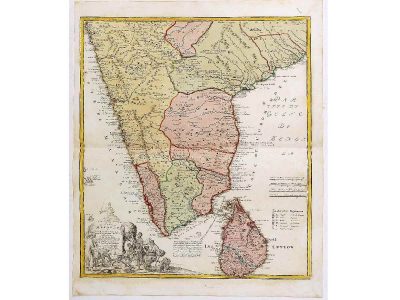
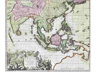
A standout piece from the collection is Johann Baptist Homann’s Peninsula Indiae Malabar Coromandel Ceylon (1733), which illustrates India’s southern regions, including Malabar, Coromandel, and Ceylon (modern-day Sri Lanka). The map offers valuable insight into the region’s historical trade routes and economic importance during that period.
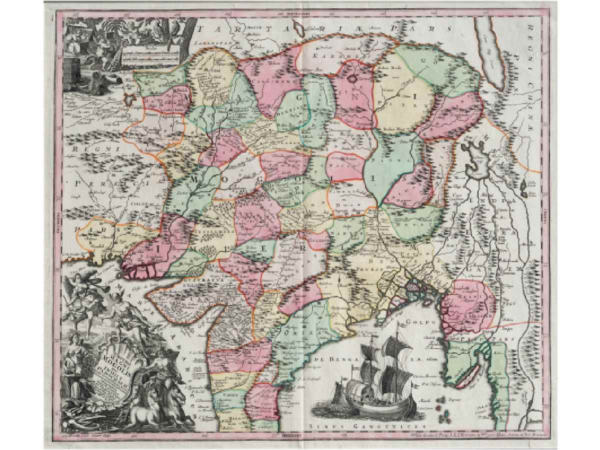
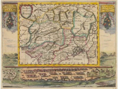
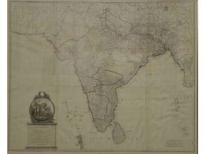
Another significant map is Imperii Magni Mogolis Sive Indici Padschach (1728), which provides a detailed representation of the Mughal Empire, stretching across present-day India and beyond. The map’s fine details highlight the empire’s influence at its height, depicting cities, trade networks, and cultural landmarks.
Rhea Sharma, a history enthusiast who visited the gallery, shared her thoughts with Patriot: “Seeing these maps up close gives a completely new perspective on how India has been shaped over the centuries. You can almost feel the weight of history in every line and detail.”
INSTRUMENTS OF POWER
During the colonial period, British, French, and Dutch cartographers mapped India with great precision, often highlighting trade routes and natural resources crucial to their imperial ambitions.
These maps were not just geographical documents; they also served as a reminder of how cartography was used to reinforce colonial dominance.
Marvelling at French cartographer Adrien-Hubert Brue’s L’Asie, Aditi Verma, a political science student, remarked: “It’s fascinating to see how maps were used to assert power and control over a land and its people, especially during the colonial period.”
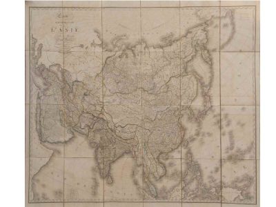
The map depicts India in exquisite detail, marking the provinces under British control.
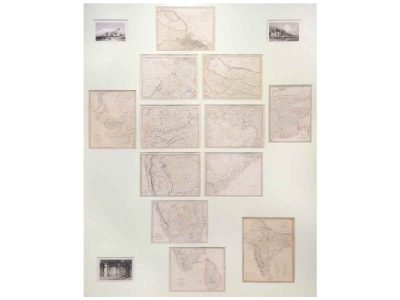
One of the most visually compelling maps in the exhibition is the 1833 series India I-XII, which delineates British-controlled territories and those under the protection of the East India Company.
These maps provide a stark visual representation of the vastness of British influence in the subcontinent and the political divisions that would eventually shape modern South Asia.
“It really makes you think about the role of geography in shaping political history,” Verma added.
SHAPING GEOGRAPHICAL UNDERSTANDING
The exhibition also explores how these historical maps have influenced contemporary understandings of India’s geography.
Pre-independence maps, in particular, highlight the complexities of India’s borders, which have been contested and redefined many times throughout history.
This collection invites visitors to reflect on how the partition of India in 1947 and the creation of new nations like Pakistan and Bangladesh were informed by these early depictions of the land.
ART IN CARTOGRAPHY
Another visitor, Rajat Menon, expressed his admiration for the craft involved in creating these maps. “The attention to detail is incredible. It’s not just about borders or cities—these maps are visual masterpieces. They show how cartographers combined art and science in their work.”
While these maps served a functional purpose, they are also recognised as artistic creations in their own respect. Many feature intricate cartouches—a decorative area containing information like the title, author, and publication date.
These cartouches sometimes include mythological figures, allegorical representations of trade, wealth, and power.
“Cartouches were a way for cartographers to showcase their artistic skills, while also symbolising the regions they were mapping,” explained Nath.
For instance, Matthäus Seutter’s 1730 map of the East Indies is adorned with depictions of gods, sea monsters, and mythical creatures, emphasising the exoticism and wealth of Asia.
The exhibition also includes educational displays and interactive elements, allowing visitors to explore the historical context of these maps in greater detail.
“This exhibition is a celebration of India’s rich cartographic history. Each map tells a story, not just about the land, but about the people, cultures, and empires that have defined this region over centuries,” added Nath.
The exhibition is open daily (except Mondays and national holidays) from 11 am to 7 pm at Ojas Art, near Qutub Minar.