India Meteorological Department (IMD), the principal agency responsible for weather observations, has forecast that India will witness ‘above normal’ monsoon this year.
The seasonal southwest monsoon over the country is likely to be 106% of the long period average (LPA), which refers to showers recorded over a region for a given interval of time over a lengthy period.
The LPA of the season rainfall over the country for 1971-2020 stands at 87 cm, so the rainfall this time is expected to be marginally above that mark.
Since 2003, IMD has been issuing forecasts for the southwest monsoon in two stages — April and late May.
The monsoons, spanning from June to September, have been predicted with a model error of positive and negative 5%.
Sanjay Srivastava, Chairman of Climate Resilient Observing Systems ProMotion Council (CROPC), an NGO which works in close conjunction with IMD, says, “The margin of 5% can depend on the diverse local conditions.”
The monsoon distribution, however also suggests that Northwest, East and Northeast India are likely to receive below normal rainfall. The IMD has a database which spans more than 100 years.
“The agency being part of a global network has good detection systems at the micro-level, employing radars and satellites,” says Srivastava.
Using state of the art statistical modelling systems, Srivastava states that IMD’s forecast accuracy can be pegged at more than 95%.
Factors contributing to ‘above normal’ rain
The forecast by IMD mentions El Nino, La Nina and the northern hemisphere snow cover as factors affecting the monsoon predictions.
El Nino and La Nina are climate patterns originating in the Pacific Ocean that have been known to affect weather worldwide. The IMD forecast predicts trends for the overall monsoon. However, as environmental activist and water expert, Himanshu Thakkar from SANDRP (South Asia Network on Dams, Rivers and People) puts it, “distribution is what matters”.
“Although the forecast predicts a below average rainfall for the period of June to July, the months of August and September will witness heavy showers due to activation of La Nina,” he says.
According to him, the showers will not only be above normal but may also compensate for the deficit that will be experienced in the first half (June-July).
India had witnessed deficit rainfall last year.
The IMD report also mentions that areas in the Northern Hemisphere have experienced below normal snow cover during the January to March period in 2024. Winter and spring snow cover over Northern Hemisphere and Eurasia has generally an inverse relationship with the subsequent Indian summer monsoon rainfall.
Is it a cause for worry?
“This year’s monsoon will be longer as south-west monsoon usually spans around 120 days with many areas in the country sometimes receiving less than 40 days of showers,” says Srivastava.
He states that such areas can receive up to 60 or even more days of shower, thus increasing crop yields and being beneficial to the country’s economy.
However, Gulfran-Ullah Beig, Chair Professor at Indian Institute of Tropical Meteorology, says that it can also be a worry.
“The prediction of above normal monsoon is good news. However, in this era of climate change, increasing extreme events is also a reality and a worry,” he says.
Climate change is also found to impact the routine cycle of La Nina and El Nino.
According to Beig, “The life of La Nina and El Nino is usually around 9-15 months. However, unusually longer life cycles are now also being recorded.
“Average statistics indicate normal rainfall even though an area might face drought while another heavy floods. India is not prepared for such extreme weather events as they are new to us,” warns Beig.
According to him, what India needs is a taluka level forecasting system which takes a good view of all micro-level climatic conditions.
The geographical and topographical diversity in the country also contributes to the unique monsoon system in the country.
“Unlike countries with year-round monsoons, India experiences them for only a couple of months, thus making prediction harder,” states Beig.
How will it impact Delhi?
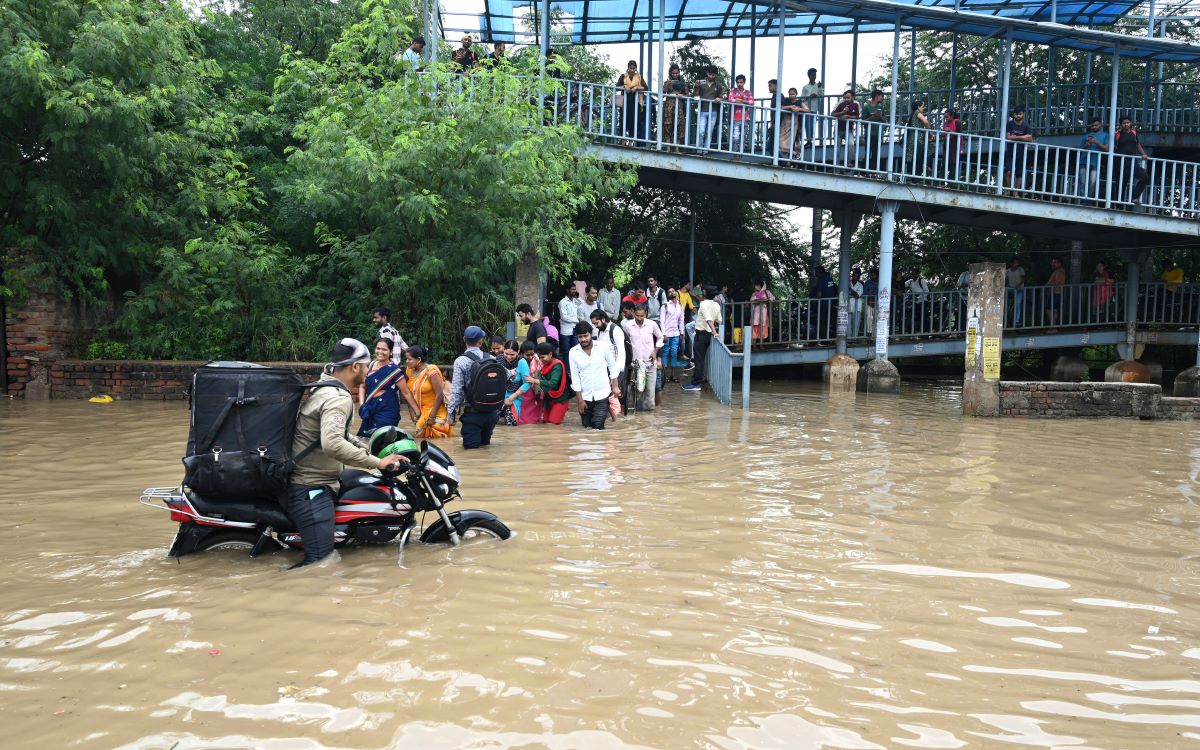
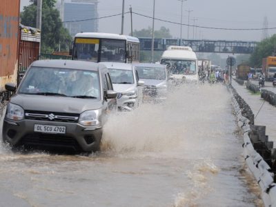
Last year, Delhi witnessed massive floods forcing people to live in rag-torn camps along the roads and bridgeways.
Several parts of the national capital got submerged under water as Yamuna crossed its evacuation mark.
Areas such as Jaitpur, Red Fort, ITO and Daryaganj were inundated after 45 years.
“Last year’s experience doesn’t really inspire much confidence,” says Thakkar.
According to Thakkar, rainfall in the first half usually saturates the dry soil.
“However, with heavy rainfall prediction in the second half, much preparedness is needed,” he says.
Srivastava assures that the Central Government has a strong preparedness mechanism with state reviews ongoing.
“This year, due to the election cycle, all stakeholders concerned understand that they have to be ready for prior action,” he stresses.
Thakkar points out that lessons still need to be learnt from Delhi’s experience last year.