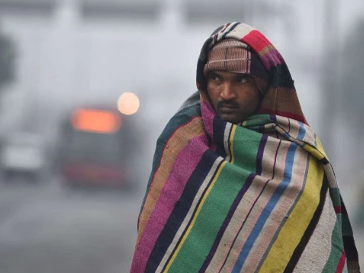
After a weeklong relief from biting cold, the national capital is set to freeze from January 6 – 7 as the minimum temperature is expected to drop to four degrees and below.
The Indian Meteorological Department has forecast that a cold wave will sweep through Delhi and parts of northern India as the mercury will drop four notches below normal season’s temperature.
“Currently, the minimum temperature is at 8 degrees, but on January 6 and 7, it will drop to four degrees and the maximum temperature will hover around 19 degrees,” says SN Shivan, a senior official at the Regional Meteorological Centre, Delhi.
In 2022, the Capital saw the season’s coldest day on Christmas when the minimum temperature dropped to 5.3 degrees. However, the weather office had clarified to Patriot that cold wave had not arrived yet.
“Delhi is experiencing cold days due to normal conditions enabled by sunny days and north-westerly winds. But there is no cold wave yet,” Kuldeep Srivastava (Sc-E) Head, Regional Forecasting Centre, RMC Delhi, had told Patriot last week.
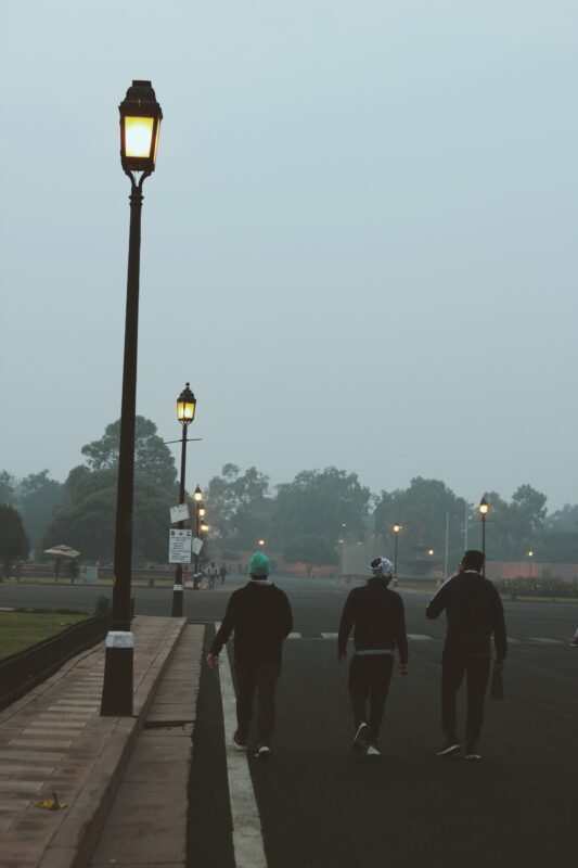
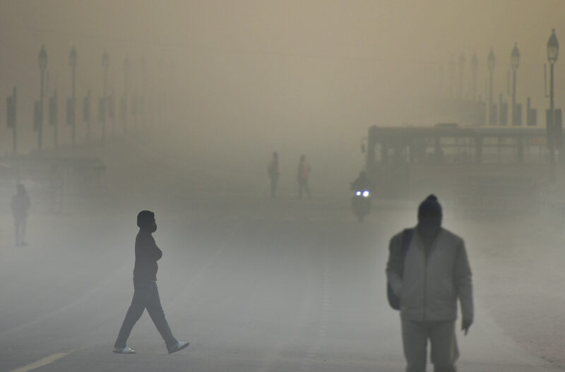
Along with increasing cold bouts, the first week of January and 2023 will mostly experience moderate to dense fog, reducing visibility in the capital city.
“Friday and Saturday will see cold wave and on Sunday, the fog situation is likely to improve. The temperature is set to be five degrees Celsius on Sunday (January 8),” says Shivan.
Cold wave
“If the minimum temperature in the plains dips to four degrees Celsius, and also when the minimum temperature is 10 degrees Celsius or below and is 4.5 notches less than normal, we declare a cold wave,” adds Shivan.
Moreover, a ‘severe’ cold wave is when the minimum temperature dips to two degrees Celsius or the departure from normal is more than 6.4 degrees Celsius.
“In the past week, there was a rising temperature trend. However, that has changed now,” Srivastava says.
Currently, north-northwesterly winds are blowing over northern India and fog hasn’t lifted completely.
Elucidating the distinction between cold wave and cold days, Srivastava said, “Cold days are not synonymous with cold wave. While cold wave is measured by monitoring the minimum temperature, for cold days we watch the maximum temperature.”
The IMD defines a cold wave in two ways – qualitative and quantitative.
Qualitatively, cold wave is a condition of air temperature, which becomes fatal to human body when exposed. Quantitatively, it is defined based on the temperature thresholds over a region in terms of actual temperature of its departure from normal.
Cold wave/severe cold wave spells are of one-two days, but in some cases in the past, spells have lasted up to 10 days. According to IMD’s analysis for the period of 1971-2010, the longest cold wave spells of 10 days or more have occured mainly over the plains of northwest and adjoining central India.
According to IMD, north Indian plains had seen an increase in the minimum temperatures with some parts of the plains even recording minimums that were above 10 degrees.
These temperatures increased due to the presence of western disturbance over the western Himalayas, which did dump some rain and snow over the higher reaches.
The pattern changed on December 31, following which cold northwesterly winds have started to blow over the plains of North India. The minimums have seen a significant drop hence. From 10 degrees Celsius, Delhi NCR has seen its minimum drop to 5.5 degrees Celsius.
In fact, other parts of north India have also seen a similar drop in the minimums. The minimum temperatures will continue to witness a drop.
These conditions will last for at least the next 5-6 days as no western disturbance is likely to make an appearance over the next few days. Due to light winds, dense fog will also be seen over some parts of north India during the morning hours.
What causes cold wave
A cold wave can result from a lack of cloud cover. A decrease in cloud cover causes more heat to escape from the earth’s surface, resulting in a cooler surface and lower temperatures because clouds absorb infrared radiation from the planet.
Technically, it is a weather event involving a cooling of the air, or the invasion of very cold air over a large area. It is marked by a drop in average temperature well below the averages of a region, the weather office said.
Besides, non-seasonal or non-monsoon rainfall is another major cause of cold waves.
Cold wave conditions in isolated areas persist for two days.
“During these days, chilly winds may aggravate cold at a time, so one should cover their head, neck, toes and nose because majority of heat loss from our bodies occur from here,” Srivastava says.
When severe cold wave persists for more than two days, there are chances of various illnesses like flu, running/stuffy nose or nosebleed, which usually set in or get aggravated due to prolonged exposure to cold.
“Do not ignore shivering. It is the first sign that the body is losing heat. One should maintain good ventilation while using heaters to avoid inhaling toxic fumes and instead of drinking alcohol (which reduces body heat), hot drinks are more advisable,” the weather office recommended.
Rain forecast
Unlike last year, when rains acted spoilsport in January, the IMD has found no rain prediction so far.
“At least, till now, we have not found western disturbances active, so chances of intense rainfall is not there this year,” says Shivan.
In 2022, Delhi recorded 88.2 mm rain against the normal of 19.3 mm making it the wettest January since 1901. Interestingly, the weather office possesses records for rainfall from January 1901.
Therefore, it was the highest rainfall in last 121 years for January.
“It is the western disturbances that bring heavy showers in January in the northern plains. This year, so far, they are inactive,” Shivan adds.
Average maximum temperature was 18 degrees, which is around 2.4 below normal. It was second lowest average of maximum temperature after 2003 when it was 17.6 degrees. The month of January, 2022 also witnessed seven cold day conditions in which two were severe cold days.
January 2022 also remained fog-free due to frequent rainfall and strong winds. The data for air quality index has been maintained since 2015. Due to intermittent rainfall and moderate north westerly winds, the air quality index of 2021 is also the lowest yet.
Number of western disturbances in the month of January 2022 was also high. There was a total of seven western disturbances against the average of five.
Follow us on:
Instagram: instagram.com/thepatriot_in/
Twitter: twitter.com/Patriot_Delhi
Facebook: facebook.com/Thepatriotnewsindia